


Title: Cold Weather Payments Triggered In Over 400 UK Postcodes, Are You Eligible For £25 Support?
Press Release: Veritas Press C.I.C.
Author: Kamran Faqir
Article Date Published: 03 Jan 2026 at 14:30 GMT
Category: UK | DWP | Cold Weather Payments Triggered in Over 400 UK Postcodes, Are You Eligible for £25 Support?
Source(s): Veritas Press C.I.C. | Multi News Agencies
Website: www.veritaspress.co.uk

Business Ads


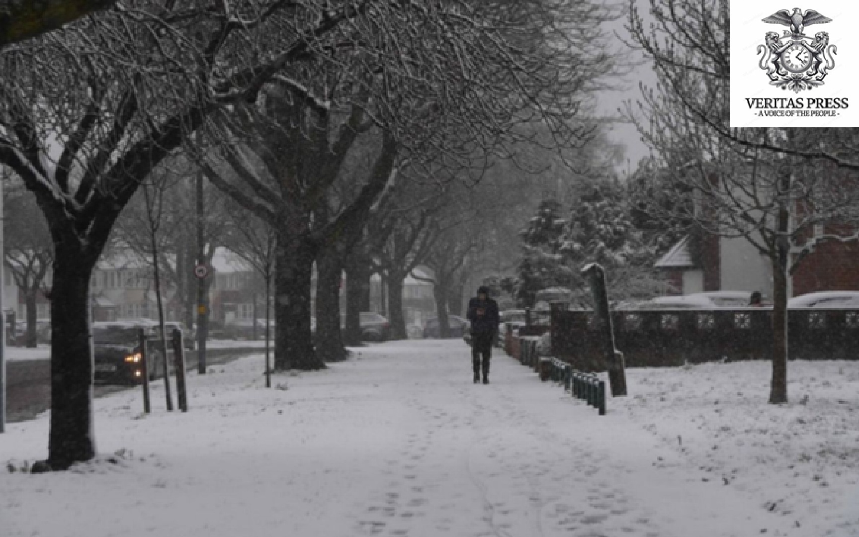
UK – As the new year begins under a bone-chilling Arctic blast, the UK is grappling with persistent sub-zero temperatures, widespread snow, and travel disruption. Against this backdrop, the Department for Work and Pensions (DWP) has confirmed that Cold Weather Payments have been triggered in over 400 postcode areas, meaning hundreds of thousands of households now qualify for financial support.
What’s Happening, Winter Weather & Warnings:
The Met Office has issued amber and yellow weather warnings for snow and ice across much of the UK, including parts of northern and eastern Scotland, as Arctic air grips the nation. Temperatures are expected to remain below average with daytime highs struggling to rise above freezing and overnight lows dipping to −10°C in places.
This has prompted health alerts from the UK Health Security Agency, warning vulnerable groups about increased cold-related health risks through at least 6 January.
What Are Cold Weather Payments?
The Cold Weather Payment scheme, run by the DWP, provides a one-off £25 payment to qualifying households for every seven-day consecutive period in which the average temperature in their area is recorded as, or forecast to be, 0°C or below.
• The scheme runs annually from 1 November to 31 March.
• If multiple cold spells occur, households can receive more than one payment.
• Payments are made automatically into the bank account used for benefit payments.
The most recent trigger, covering the period 30 December 2025 to 2 January 2026, has been confirmed in 441 postcode areas, with an estimated 674,000 households set to receive payments.
According to DWP figures, this winter will likely see multiple triggers if the Arctic conditions persist, and households could see successive £25 payments for each qualifying week.
Who Is Eligible?
To qualify for Cold Weather Payments, a household must:
- Be living in an area where temperatures reached or were forecast to reach 0°C or below for 7 days.
- Be receiving one or more of the following benefits:
- Pension Credit
- Income Support
- Income-based Jobseeker’s Allowance (JSA)
- Income-related Employment and Support Allowance (ESA)
- Universal Credit (with additional conditions)
- Support for Mortgage Interest (SMI)
Note: Universal Credit claimants must also meet specific eligibility conditions, such as having limited capability for work or caring responsibilities, to qualify.
Scotland Exception:
Although the cold weather affects Scotland too, residents do not receive DWP Cold Weather Payments. The Scottish Government offers a separate annual Winter Heating Payment for eligible low-income households, paid irrespective of temperatures, instead of the DWP scheme.
When Will You Get The Payment?
The payments are automatic; there’s no application to make. If you qualify, the £25 should appear in your bank account, usually within 14 working days after the end of the qualifying cold spell, with the reference ‘DWP CWP’.
If you believe you should have received a payment but haven’t, contact the DWP or, for Universal Credit claimants, use your online journal or helpline to report it.
Government Response & Political Context:
Minister for Pensions Torsten Bell said the Cold Weather Payments are designed to deliver “automatic support directly to vulnerable households as temperatures plunge.” He added that this is just part of a wider strategy, including the “biggest ever Pension Credit take-up campaign” and the government’s long-term Triple Lock pension guarantee, expected to increase the State Pension by up to £2,100 over the course of this Parliament.
Campaigners and charities, however, argue that £25 per cold spell barely scratches the surface of soaring energy costs and that more could be done to protect those most vulnerable to fuel poverty during increasingly volatile winters.
What This Means For Household Budgets:
For some families, particularly those on low incomes or with underlying health conditions, these payments can make a tangible difference to heating bills, especially in rural or high‑altitude areas where cold spells can stretch into multiple weeks.
Last winter, several communities in the Lake District received up to three Cold Weather Payments (a total of £75), illustrating how prolonged cold can translate to repeated support.
That said, with energy costs still a major concern, local authorities and support organisations are encouraging eligible residents to explore additional schemes such as:
- Warm Home Discount
- Household Support Fund
- Priority Services Register for extra help from energy suppliers
…and tools like the government postcode checker to track whether your area has triggered a Cold Weather Payment.
Key Takeaways:
- 674,000+ households across 441–451 postcodes will receive £25 payments.
- Payments happen when temps stay at or below 0°C for 7 days.
- Eligibility depends on specific benefits, and extra criteria for some.
- People in Scotland get separate Winter Heating Payments.
- Payments require no claim — they’re automatic, arriving within ~14 days.
Want To Check If You’re Eligible?
Use the UK government’s Cold Weather Payment postcode checker on gov.uk, entering your postcode to see whether your local temperatures have triggered support, or contact your local benefits advisor for personalised assistance.
If you are on universal credit, you can use your online journal or call the universal credit helpline to report it.
Unsure if your postcode is eligible? Check using the postcode tracker tool on gov.uk.
The list of postcodes triggered are:
North Yorkshire / Craven
- BD23 – Skipton and surrounding villages
- BD24 – Settle area
- DL8 – Leyburn / Wensleydale
- DL11 – Reeth / Swaledale
County Durham & Darlington Area
- DH1 – Durham
- DH6 – Bowburn / Coxhoe area
- DH7 – Sacriston / Lanchester area
- DH8 – Consett
- DH9 – Stanley
- DL4 – Shildon
- DL5 – Newton Aycliffe
- DL12 – Barnard Castle
- DL13 – Stanhope / upper Weardale
- DL14 – Bishop Auckland
- DL15 – Crook
- DL16 – Spennymoor
- DL17 – Ferryhill / Chilton
- TS21 – Sedgefield / west of Stockton
- TS28 – Wingate
- TS29 – Trimdon Station / Deaf Hill
Cumbria / Brecon & Mid‑Wales Fringe
- LD3 – Brecon and surrounding area (Powys)
Cambridgeshire (Cambridge, Ely, South Cambs, East Cambs)
- CB1, CB2, CB3, CB4, CB5 – Cambridge city districts
- CB6, CB7 – Ely and nearby villages
- CB10, CB11 – Saffron Walden area (Essex, but in the CB area)
- CB21, CB22, CB23, CB24, CB25 – South and east Cambridgeshire villages (Linton, Sawston, Cambourne, Cottenham, Bottisham, etc.)
- PE19 – St Neots (Hunts / Cambs edge)
Essex (Chelmsford, Braintree, Maldon, Uttlesford, Harlow)
- CM1, CM2 – Chelmsford
- CM3 – Rural east of Chelmsford / South Woodham Ferrers fringe
- CM4 – Ingatestone
- CM5 – Ongar
- CM6 – Great Dunmow (Uttlesford)
- CM7, CM77 – Braintree districts
- CM8 – Witham
- CM9 – Maldon / Heybridge
- CM11, CM12 – Billericay
- CM13, CM14, CM15 – Brentwood
- CM16 – Epping
- CM17, CM18, CM19, CM20 – Harlow
- CM21 – Sawbridgeworth
- CM22, CM23, CM24 – Takeley / Bishop’s Stortford / Stansted Mountfitchet
- CO9 – Halstead area
- RM4 – Rural fringe: Havering‑atte‑Bower / Stapleford Abbotts / Abridge (Essex–London border)
Hertfordshire & Bedfordshire (SG + Parts Of CM/MK)
- SG5 – Hitchin and surrounding villages (Herts/Beds)
- SG6 – Letchworth Garden City
- SG7 – Baldock
- SG8 – Royston and surrounding villages
- SG9 – Buntingford
- SG10, SG11 – Much Hadham / Standon / Puckeridge area
- SG15 – Arlesey
- SG16 – Henlow
- SG17 – Shefford
- SG18 – Biggleswade
- SG19 – Sandy and nearby villages
- MK40, MK41, MK42 – Bedford
- MK43 – Marston Moretaine / Cranfield area
- MK44 – North‑east Bedford rural
- MK45 – Ampthill / Flitwick
- MK46 – Olney (Bucks/Beds/Northants border
Milton Keynes & North Buckinghamshire
- MK1, MK2, MK3 – Bletchley districts
- MK4, MK5, MK6, MK7, MK8, MK9, MK10, MK11, MK12, MK13, MK14, MK15 – Milton Keynes urban districts
- MK16 – Newport Pagnell
- MK17 – Woburn Sands and nearby villages
- MK18 – Buckingham and villages
- MK19 – Hanslope / rural north‑west of MK
Northamptonshire
- NN1, NN2, NN3, NN4, NN5 – Northampton urban area
- NN6, NN7 – Rural north and south‑west of Northampton
- NN8 – Wellingborough
- NN9 – Raunds / Irthlingborough
- NN10 – Rushden
- NN11 – Daventry
- NN12 – Towcester
- NN13 – Brackley
- NN29 – Wollaston and nearby villages
Norfolk (Norwich, King’s Lynn, Breckland, North Norfolk, Great Yarmouth, Waveney)
- NR1, NR2, NR3, NR4, NR5, NR6, NR7 – Norwich city and suburbs
- NR8, NR9, NR10 – Taverham / Drayton / Hethersett / Coltishall belts
- NR11, NR12, NR13 – North‑east Norfolk / Broads villages
- NR14, NR15 – Poringland / Loddon / Long Stratton
- NR16, NR17, NR18 – East Harling / Attleborough / Wymondham area
- NR19, NR20 – Dereham and rural surrounds
- NR21 – Fakenham
- NR22, NR23 – Walsingham / Wells‑next‑the‑Sea area
- NR24, NR25 – Melton Constable / Holt / Blakeney
- NR26 – Sheringham
- NR27 – Cromer
- NR28 – North Walsham
- NR29 – Martham / north of Great Yarmouth
- NR30, NR31 – Great Yarmouth / Gorleston
- NR32, NR33 – Lowestoft (Suffolk)
- NR34 – Beccles (Suffolk/Norfolk border)
- NR35 – Bungay (Suffolk/Norfolk border)
- PE30, PE31, PE32, PE33, PE34, PE35, PE36, PE37, PE38 – King’s Lynn, Hunstanton, Swaffham, Downham Market and surrounding Norfolk villages
Suffolk / Norfolk Fringe (Thetford, Brandon, Mildenhall)
- IP24 – Thetford (Breckland, Norfolk, close to Suffolk border)
- IP25 – Watton (Breckland)
- IP26 – Mundford and villages
- IP27 – Brandon (Suffolk/Norfolk border)
- IP28 – Mildenhall / Lakenheath (Suffolk)
- PE12, PE13, PE14 – Long Sutton / Holbeach / Wisbech and Fens (Lincs/Cambs/Norfolk fringes)
North‑East England (Northumberland / Tyne Valley)
- NE18 – Stamfordham area (Northumberland)
- NE20 – Ponteland
- NE44 – Riding Mill
- NE45 – Corbridge
- NE46 – Hexham
South Wales – Cardiff, Valleys, Gwent
- CF37, CF38 – Pontypridd / Tonteg / Llantwit Fardre (Rhondda Cynon Taf)
- CF39, CF40, CF41, CF42, CF43 – Porth, Tonypandy, Pentre, Treorchy, Ferndale (Rhondda Cynon Taf)
- CF44, CF45 – Aberdare / Mountain Ash (Rhondda Cynon Taf)
- CF46 – Treharris (Merthyr Tydfil / Caerphilly border)
- CF47, CF48 – Merthyr Tydfil districts
- CF81, CF82 – Bargoed / Ystrad Mynach (Caerphilly)
- CF83 – Caerphilly and Bedwas area
- NP4 – Pontypool (Torfaen)
- NP11 – Risca / Abercarn (Caerphilly)
- NP12 – Blackwood (Caerphilly)
- NP13 – Abertillery (Blaenau Gwent)
- NP22 – Tredegar (Blaenau Gwent)
- NP23 – Ebbw Vale (Blaenau Gwent)
- NP24 – New Tredegar (Caerphilly/Blaenau Gwent)
- NP44 – Cwmbran (Torfaen)